Winslow Indian Sanatorium Cemetery
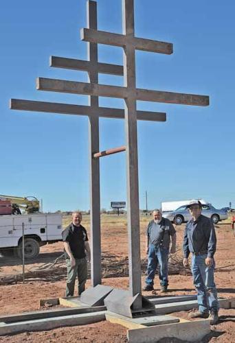
The Winslow Indian Sanatorium Cemetery was established in 1932 as a component of the planning and construction of the Winslow Regional Tuberculosis Sanatorium. The sanatorium dedication and open house was held in November 1933 and was the beginning of the operations after a yearlong construction phase. The McKee Company of El Paso, TX constructed the Winslow Indian Sanatorium in 1932. The McKee Co. also built many edifices still being used in the community of Winslow including the “LaPosada” Fred Harvey House, Winslow TAT (Winslow-Lindbergh Regional) Airport, and Post Office. The Winslow Sanatorium was established in Winslow for its dry climate and mild winters. Legislation to construct the sanatorium was a cooperative effort initiated by Arizona Senator, Carl Hayden of Tempe.
Groundbreaking for the regional tuberculosis sanatorium was done in 1932 and dedicated in January 1933. The land utilized for the sanatorium cemetery is on land patented to the Town of Winslow on October 6, 1916 by President Wilson for the establishment of a cemetery. The sanatorium cemetery is north east of the sanatorium undistinguished as a pauper’s field. The sanatorium was used for tuberculosis patients from all across the Southwest region of the United States selectively serving the Navajo and Hopi Indians from the remote high desert reservations.
As more sanatoriums were being built in Phoenix and in California to service non-Indians, the Winslow Sanatorium was transferred to the United States Department of the Interior, Bureau of Indian Affairs, Navajo Health Authority in 1935. The tuberculosis sanatorium became a traditional hospital through the late nineteen thirties, and established a maternity ward in 1940. The hospital continued to operate as a fully staffed medical facility until 1978, when it was reorganized as Indian Health Services (I.H.S.) and became an ambulatory facility. On August 16, 2002 it was reorganized and now operates as the Winslow Indian Health Care Center providing clinical care for the Navajo Nation.
The cemetery was utilized for the convenience of the sanatorium staff. The vast Navajo and Hopi Reservations north of Winslow lacked roads and modern day conveniences. The attempt to notify the family of the deceased often was not attempted. The cemetery provided for the immediate disposal of the deceased, when a family member was not physically available. They would wait for the family to return and then present them with the news. The cemetery today sits as a mute testimony of the heartbreak for many families. Closure for some, never came.
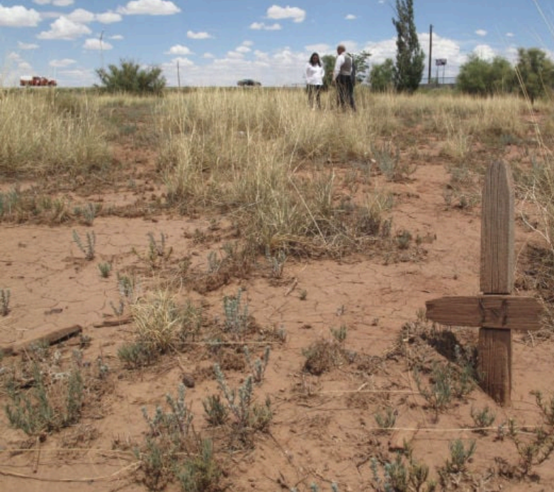
The sanatorium staff often encountered difficulties in locating the next of kin on the vast and remote reservations of northern Arizona and New Mexico. The funeral-burial was performed within the traditional cultural time periods for the deceased and the grave marked with an engraved wooden cross-shaped marker. The grave markers included name, date of birth if known and date of death.
While the sanatorium served as a maternity hospital, many graves represent a stark reminder of the high rate of infant mortality suffered by our indigenous citizens. The lack of beneficial nutrition and prenatal care made for much heartache. Many of the graves included in the index are infants and small children.
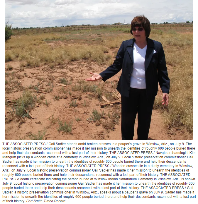
The City of Winslow Historic Preservation Commission, voted to make a difference. We gathered limited historical information; continuing earlier work started in the late 1980’s early 1990’s by a local group of concerned citizens (Tom McCauley, Brian Weisenhunt, Kenneth Evans) . The graves, when initiated, were marked with wooden crosses bearing at the time of death, the individuals name, date of birth if known and date of death. Decades of neglect and vandalism prompted locals to contact city officials to provide a cleanup of the cemetery area.
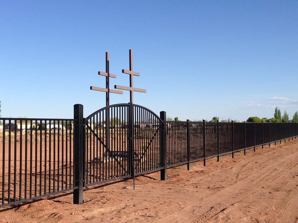
During a city property cleanup project in 1990, using inmate labor from the new Winslow Arizona State Prison Complex. The cemetery was cleaned and and fenced with barbed wire. Lacking direction, prison inmate laborers were advised to rake up all of the old wooden crosses and trash and weeds and burn it, devoiding the area of all un-necessary trash and clutter. This destroyed the last know physical identification records for hundreds of graves. Today, less than 30 of over 543 graves are still marked. Even after the cemetery was fenced it served as a place for locals to dispose of their household trash, entertainment for vandals to disturb graves and off highway vehicles to make new trails.
We have been unable to find a plot map for the cemetery, nor has the Winslow Indian Health Center been able to provide any records assistance for the cemetery recording project.
The City of Winslow Historic Preservation Commission reviewed archival materials to build an index of names and genealogical information of the deceased.
Cemetery Location: northeast of junction of Historic Beale Wagon Road and West Desmond Street, Winslow, Navajo County, Arizona.
Gila and Salt River Baseline and Meridian, Township 19 North Range 15 East, Section # 24.
UTM reference is: Zone 12 Easting: 526610 Northing 3877388
USGS 7.5’ quad map: Winslow, Arizona
GPS Coordinates:
NW Corner Lat: 35.03883 Long: -110.70825
NE Corner Lat: 35.03884 Long: -110.70691
SW Corner Lat: 35.03781 Long: -110.70804
NE Corner Lat: 35.03785 Long: -110.70694
The cemetery may extend beyond the State of Arizona Department of Transportation Fence, being when the 1974 RT 66 bypass was started, no survey of record of the cemetery was brought to ADOT’s attention.
